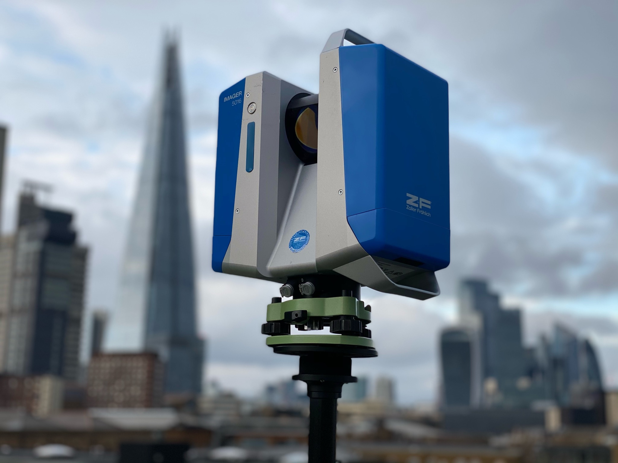
ZF 3D Laser Scanner with Shard in Background 5

The Transformative Power of 3D Laser Scanning Technology

The Transformative Power of 3D Laser Scanning Technology

Introduction to 3D Laser Scanning Technology

3D laser scanning technology is revolutionising various industries, offering unparalleled precision and efficiency. This innovative technology captures the exact size and shape of physical objects using laser light, creating highly detailed 3D models. Industries such as construction, archaeology, and manufacturing are leveraging this technology to enhance accuracy and streamline their processes.

How 3D Laser Scanning Works

Laser Emission and Reflection

The process begins with a laser scanner emitting a laser beam. When this beam hits an object, it reflects back to the scanner, which records the distance between the scanner and the object.

Data Collection

Millions of these distance measurements, or data points, are collected per second, forming a “point cloud.” This cloud represents the surface of the object in three dimensions.

Creating the 3D Model

Software then processes this point cloud to create a detailed 3D model, which can be used for various applications, from virtual inspections to precise measurements.

Applications of 3D Laser Scanning Technology

Construction and Architecture

3D laser scanning is pivotal in construction and architecture, enabling precise measurements and detailed visualisations. Architects and builders use this technology to create accurate building plans and monitor construction progress, reducing errors and ensuring projects stay on schedule.

Architectural Floor Plans

Point clouds are used to create highly accurate architectural floor plans. These plans provide detailed spatial information, essential for designing and renovating buildings.

Engineering “As-Built” Drawings

In engineering, 3D laser scanning produces “as-built” drawings, which document the exact state of a structure at a specific point in time. These drawings are crucial for maintenance, renovations, and ensuring compliance with design specifications.

Archaeology and Heritage Preservation

In archaeology, 3D laser scanning is used to document and preserve historical sites and artefacts. This technology allows for the creation of exact replicas of artefacts, which can be studied without damaging the originals.

Manufacturing and Quality Control

Manufacturers use 3D laser scanning for quality control, ensuring products meet precise specifications. This technology is also utilised in reverse engineering to create detailed models of existing products for improvement or duplication.

Benefits of 3D Laser Scanning Technology

Precision and Accuracy

One of the primary benefits of 3D laser scanning is its unparalleled precision. It can capture minute details that are often missed by traditional measurement methods, ensuring high accuracy in data collection.

Efficiency

3D laser scanning significantly reduces the time required for measurement and documentation. This efficiency translates into cost savings and faster project completion times.

Versatility

The versatility of 3D laser scanning technology makes it suitable for various applications across different industries. From documenting historical artefacts to ensuring manufacturing quality, its applications are vast and diverse.

Future Trends in 3D Laser Scanning Technology

Integration with BIM

Building Information Modeling (BIM) is increasingly integrating 3D laser scanning technology to create comprehensive digital representations of physical and functional characteristics of buildings. This integration enhances collaboration and improves project outcomes.

Advancements in Portable Scanners

As technology advances, portable 3D laser scanners are becoming more prevalent, allowing for on-site data collection. These advancements make the technology more accessible and convenient for various applications.

Increased Automation

Automation is set to play a significant role in the future of 3D laser scanning. Automated scanners and software will streamline data processing, making the technology even more efficient and user-friendly.

Conclusion

3D laser scanning technology is transforming industries by offering unmatched precision, efficiency, and versatility. As this technology continues to advance, its applications will only expand, driving innovation and improving processes across various sectors.

Call to Action

✨ Ready to transform your business with 3D laser scanning technology? Contact us today to learn more about how our cutting-edge solutions can benefit your projects! Share this post and follow us for more updates on the latest in 3D technology. ✨

surveying instrument with construction site in background 2

Accurate Surveying Solutions: Precision for Your Projects

Accurate surveying is essential for the success of construction, engineering, and development projects. Precision in surveying not only ensures the smooth execution of plans but also mitigates risks, saves costs, and enhances overall project quality. This article delves into the significance of accurate surveying solutions, focusing on the role of 3D laser scanning services, various surveying techniques, and their benefits. Whether you’re planning a small development or a large-scale construction project, understanding the importance of accurate surveying is crucial.

The Importance of Accurate Surveying

Accurate surveying is vital for the precise mapping of project sites, ensuring that every detail is captured accurately. This precision is crucial for several reasons:

  1. Enhanced Project Planning: Accurate surveys provide detailed site information, allowing for better planning and decision-making. This leads to more efficient resource management and project timelines.
  2. Improved Construction Quality: Precision in measurements ensures that structures are built correctly, reducing the risk of errors and enhancing the overall quality of construction.
  3. Regulatory Compliance: Accurate surveys help ensure that projects meet all legal and regulatory requirements, avoiding fines and project delays.
  4. Risk Mitigation: Identifying potential issues early through accurate surveys helps mitigate risks and prevent costly rework.
  5. Cost Savings: While investing in accurate surveying may seem expensive initially, it can lead to significant cost savings by preventing errors and ensuring efficient project execution.

Tools and Techniques in Accurate Surveying

Several advanced tools and techniques are used in modern surveying to achieve high accuracy. Here are some of the most effective methods:

3D Laser Scanning Technology

  • How 3D Laser Scanning Works: 3D laser scanning involves emitting laser beams that bounce off surfaces and return to the scanner, which calculates distances with high precision based on the time it takes for the laser to return. This process generates a comprehensive point cloud, representing the scanned area or object in great detail.
  • Applications and Benefits: 3D laser scanning is used across various industries, including construction, heritage conservation, and engineering surveys. It provides accurate building measurements and facilitates detailed documentation, making it essential for renovation projects and architectural design.

Global Positioning System (GPS)

  • Enhancing Surveying Accuracy with GPS: GPS technology provides real-time data on location and elevation, making it a powerful tool for precise mapping and measurements. It is especially useful in large, open areas where traditional surveying methods may be less effective.
  • Applications and Benefits: GPS is widely used in land surveying, construction, and infrastructure projects. It enables quick data collection and reduces the need for manual measurements, thus saving time and reducing errors.

Total Stations

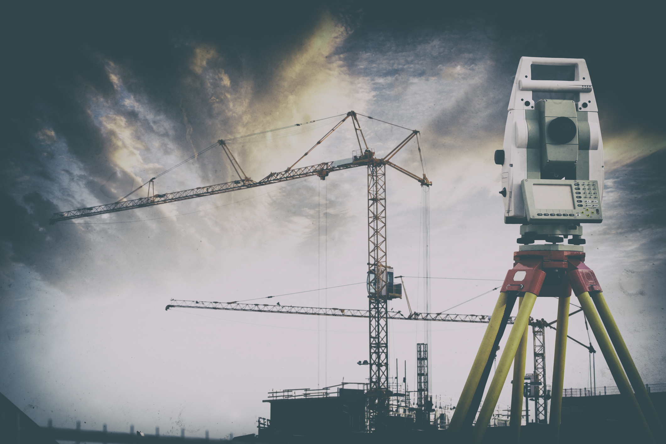
  • Description and Use in Surveying: Total stations are electronic/optical instruments used in modern surveying. They combine the functions of a theodolite for measuring angles and an electronic distance meter (EDM) for measuring distance.
  • Advantages: Total stations provide high accuracy in both angle and distance measurements, making them ideal for detailed site surveys and construction layout.

Drones and Aerial Surveying

  • Role of Drones in Modern Surveying: Drones equipped with high-resolution cameras and sensors can capture detailed aerial images and data, providing a comprehensive view of the project site.
  • Benefits: Drones are particularly useful in surveying large or hard-to-reach areas. They offer quick data collection, high-resolution imagery, and the ability to survey areas that might be dangerous or inaccessible for humans.

LiDAR (Light Detection and Ranging)

  • Explanation of LiDAR Technology: LiDAR uses laser light to measure distances and create detailed 3D maps of the surveyed area. It is highly effective in capturing fine details and generating precise models.
  • Specific Uses and Benefits: LiDAR is used in various applications, including topographic mapping, forestry, and urban planning. Its ability to penetrate dense vegetation and other obstacles makes it invaluable in detailed and accurate site surveys.

Benefits of Using Accurate Surveying Solutions

Accurate surveying solutions offer numerous benefits, contributing to the success and efficiency of projects. Here are some of the key advantages:

Enhanced Project Planning

  • Improved Planning and Execution: Accurate data from surveys allow for detailed and informed project planning. This results in better resource management and more efficient project timelines.
  • Example: In construction projects, precise surveys help in creating accurate blueprints and ensuring that all elements fit together as planned, reducing the likelihood of errors and delays.

Improved Construction Quality

  • Higher Construction Standards: Precision in surveying translates to higher construction quality, as structures are built according to exact specifications.
  • Example: Accurate surveys ensure that foundations are laid correctly, structural components align properly, and overall construction integrity is maintained.

Regulatory Compliance

  • Meeting Legal Requirements: Accurate surveying helps ensure that all aspects of the project comply with local laws and regulations.
  • Example: Surveys that meet regulatory standards help avoid fines and legal issues, ensuring smooth project approval and execution.

Risk Mitigation

  • Reducing Project Risks: Accurate data helps identify potential issues early in the project, allowing for proactive risk management.
  • Example: By detecting ground instability or other site issues early, project teams can take corrective measures before construction begins, preventing costly setbacks.

Cost Savings

  • Financial Benefits of Accuracy: Investing in accurate surveying can lead to significant cost savings by minimising rework, avoiding delays, and ensuring efficient project execution.
  • Example: Accurate initial surveys reduce the likelihood of errors during construction, preventing expensive rework and project overruns.

Choosing the Right Surveying Solution

Selecting the right surveying solution depends on the specific needs of your project. Here are some factors to consider:

Project Size and Scope

  • Matching Techniques to Project Requirements: Larger projects may require more advanced surveying techniques, such as aerial surveying or LiDAR.
  • Example: A large infrastructure project might benefit from the comprehensive data provided by aerial surveys, while a smaller development might only need basic GPS and total station surveys.

Budget

  • Balancing Cost and Benefits: While accurate surveying can save money in the long run, it’s essential to choose a solution that fits within your budget.
  • Example: For budget-conscious projects, a combination of GPS and traditional surveying methods might be more cost-effective than investing in the latest technology.

Regulatory Requirements

  • Ensuring Compliance: Ensure that the chosen surveying method complies with local laws and regulations.
  • Example: Certain projects may require surveys that meet specific standards or certifications, necessitating the use of approved methods and technologies.

Terrain and Accessibility

  • Adapting to Site Conditions: Consider the terrain and accessibility of the project site. Drones and GPS may be more suitable for difficult-to-reach areas.
  • Example: In rugged or densely vegetated areas, drones and LiDAR can provide detailed surveys without the need for extensive ground access.

Expertise

  • Hiring Skilled Surveyors: Ensure that the surveying team has the necessary expertise and experience. Look for professionals with a proven track record in delivering accurate results.
  • Example: Experienced surveyors can provide valuable insights and recommendations, ensuring the accuracy and reliability of the survey data.

single post gal 1
blog image 9
single post gal 2

FAQs

Q: What is the role of a surveyor in construction?

  • Answer: Surveyors play a crucial role in construction by providing accurate measurements and data for site planning, design, and layout. They ensure that all construction elements are positioned correctly and meet regulatory requirements.

Q: How does GPS improve surveying accuracy?

  • Answer: GPS technology enhances surveying accuracy by providing real-time location data with high precision. This reduces the potential for human error and speeds up the data collection process.

Q: What are the benefits of using drones in surveying?

  • Answer: Drones offer several benefits, including quick data collection, high-resolution imagery, and the ability to survey large or inaccessible areas. They enhance the efficiency and safety of surveying projects.

Q: What is LiDAR technology used for?

  • Answer: LiDAR technology is used for creating detailed 3D maps of the surveyed area. It is particularly useful in topographic mapping, forestry, urban planning, and any application requiring precise spatial data.

Q: How does accurate surveying contribute to cost savings?

  • Answer: Accurate surveying contributes to cost savings by reducing errors, preventing rework, and ensuring efficient project execution. It helps identify potential issues early, allowing for proactive management and cost-effective solutions.
pipelines engineer

3D Laser Scanning Industry Applications

3D laser scanning offers unparalleled accuracy and efficiency across various industries, from construction and architecture to heritage conservation and engineering.

At Geo Scan, we apply this advanced technology to capture precise data for a range of applications, ensuring that every project has a solid foundation of high-quality, detailed information.

Explore how different industries are harnessing the power of 3D laser scanning to improve accuracy, efficiency, and project outcomes.


Industry Applications of 3D Laser Scanning

Architectural Design

In the realm of architectural design, measured surveys and 3D laser scanning provide the backbone for documenting existing structures with unparalleled accuracy. These technologies facilitate the creation of detailed as-built measurements, enabling architects to produce precise floor plans, elevations, and cross-sections. The integration of 3D modelling and visualisation tools further empowers design development, offering a vivid representation of spaces for client presentations and enhancing the overall design process.

Property Development and Real Estate

The real estate and property development sectors leverage point cloud surveys and 3D laser scanning to revolutionize how properties are marketed and assessed. From creating immersive virtual tours to conducting thorough land and topographic surveys, these tools are indispensable for feasibility studies and the preservation of heritage buildings. They ensure that every detail, from historical significance to structural integrity, is accurately documented for conservation efforts.

Engineering and Construction

In engineering and construction, accurate measurements are vital for structural analysis, clash detection, and ensuring seamless integration of building systems. 3D laser scanning and point cloud technology provide essential data for monitoring construction progress and facilitating as-built comparisons, which are crucial for maintaining quality control and adhering to project specifications.

Facilities Management

Facilities management benefits greatly from the detailed building information models (BIM) generated through measured surveys and 3D scanning. These models are instrumental in asset management, maintenance planning, and optimizing space utilization. By integrating scanned data with facility management software, managers can conduct thorough space utilization analyses, ensuring efficient operation of facilities.

Building Inspections and Assessments

Comprehensive documentation of existing conditions is essential for pre-purchase inspections, structural assessments, and planning maintenance or repairs. Measured surveys and 3D laser scanning offer a detailed overview of building energy efficiency and thermal performance, aiding in the identification of potential issues and ensuring buildings meet safety standards.

Historic Preservation and Heritage Documentation

The preservation of historical buildings and cultural heritage sites relies on the detailed records generated by measured surveys and 3D laser scanning. These technologies offer a digital means of preservation, creating accurate floor plans, elevations, and 3D models that serve as a foundation for restoration and conservation planning, ensuring the longevity of our architectural history.

Interior Design and Space Planning

For interior design and space planning, precise documentation of existing interiors is crucial. Measured surveys and 3D laser scanning facilitate the creation of detailed 3D models, enabling designers to visualize spatial relationships, plan furniture layouts, and ensure accessibility, thereby enhancing the functionality and aesthetics of interior spaces.

Forensic Investigations and Insurance

In forensic investigations and insurance, the accuracy of documentation is paramount. 3D laser scanning provides detailed visualization and reconstruction of crime scenes or accidents, aiding in the analysis of incidents for insurance claims. This technology ensures that every aspect of the scene is accurately captured, providing a reliable basis for investigations.

Urban Planning and Development

Urban planning and development benefit from the detailed mapping and documentation capabilities of measured surveys and 3D laser scanning. These technologies assist in analyzing building densities, urban design elements, and simulating development scenarios, offering valuable insights for city planning and the enhancement of urban environments.

Building Documentation and Archives

Creating comprehensive building documentation and archives is essential for preserving architectural heritage. Measured surveys and 3D laser scanning play a crucial role in digital preservation, enabling the integration of scanned data into building management systems or databases for future research and accessibility.

Oil and Gas Refineries and Petrochemical Plants

In the complex environments of oil and gas refineries and petrochemical plants, as-built measurement and 3D modelling are critical for retrofitting, maintenance, and assessing structural integrity. These technologies provide detailed documentation of facilities, ensuring safe and efficient operation within these critical infrastructure sectors.

Marine and Offshore Industries

The marine and offshore industries require precise documentation for retrofitting and repair projects. Measured surveys and 3D laser scanning offer detailed insights into ship interiors, decks, and hulls, as well as offshore structures, facilitating maintenance, inspection, and ensuring the longevity and safety of marine operations.

Mining and Quarrying

For mining and quarrying operations, surveying and documentation are essential for understanding and managing sites. Technologies like 3D laser scanning enable accurate measurement and analysis of mines, aiding in volume calculations, terrain modelling, and monitoring land movement, ensuring environmental and operational safety.

Cultural Heritage Preservation

Cultural heritage preservation relies on the detailed documentation of archaeological sites and artefacts. Measured surveys and 3D laser scanning enable the creation of accurate 3D models for virtual experiences, aiding in conservation planning and ensuring the preservation of our cultural landscapes for future generations.

Forestry and Environmental Monitoring

In forestry and environmental monitoring, measuring and mapping forested areas provide critical data for managing ecosystems. These technologies assist in estimating biomass, analysing terrain, and monitoring landscape changes, contributing to sustainable environmental planning and conservation efforts.

Transportation Infrastructure

The documentation of transportation infrastructure is crucial for design, maintenance, and safety assessments. Measured surveys and 3D laser scanning provide accurate as-built documentation, aiding in the analysis of conditions and deformations, ensuring the structural health and safety of roads, bridges, and railways.

Industrial and Manufacturing Facilities

Industrial and manufacturing facilities benefit from detailed measurement and documentation for layout planning and equipment installation. These technologies facilitate the analysis of workflows and safety considerations, enhancing efficiency and ensuring a safe working environment.

Power Generation

In power generation, detailed measurement and analysis are essential for maintaining and retrofitting facilities. Measured surveys and 3D laser scanning offer comprehensive documentation of complex systems, ensuring efficient operation and aiding in the design verification and optimisation of power plants.

Healthcare and Hospitals

For healthcare and hospitals, accurate documentation of interiors is vital for facility planning and renovations. These technologies assist in creating optimal designs that enhance patient flow and accessibility, contributing to a better healthcare environment and improving patient care.

Education and Research

Educational institutions and research facilities require precise documentation for space utilisation analysis and facility management. Measured surveys and 3D laser scanning support the optimisation of educational spaces, facilitating a conducive learning environment and aiding in research endeavors.

Sports and Recreation

Sports venues and recreational facilities benefit from the detailed measurement and documentation for event planning and spectator experience optimisation. These technologies enable the analysis of sightlines and crowd flow, ensuring safety and enhancing the enjoyment of sporting events.

Retail and Commercial Spaces

In the retail and commercial sector, accurate documentation of spaces is essential for layout planning and customer flow analysis. Measured surveys and 3D laser scanning aid in the design of engaging retail environments, optimising user experience, and driving commercial success.

Telecommunications and Data Centres

In the fast-paced world of telecommunications and data centres, measured surveys using 3D laser scanning are revolutionizing the way infrastructure is documented and analysed. These technologies enable the creation of detailed floor plans, elevations, and sections, allowing for meticulous planning and optimisation of network coverage and signal propagation.

Schools and Educational Facilities

Schools and educational facilities benefit immensely from measured surveys and 3D laser scanning, providing accurate documentation of classrooms, libraries, and common areas. This data aids in creating comprehensive floor plans, elevations, and sections, which are essential for effective space utilisation analysis, facility planning, and renovations. By understanding spatial relationships and accessibility, educational institutions can optimise their environments for both learning and safety.

Care Homes and Assisted Living Facilities

Measured surveys and 3D laser scanning play a crucial role in enhancing the living conditions within care homes and assisted living facilities. Through the creation of detailed 3D models, facility managers can engage in effective space planning and accessibility assessments. This ensures that spatial configurations and ergonomic considerations are tailored to enhance the well-being and comfort of residents, fostering environments that support their needs and preferences.

Museums and Galleries

For museums and galleries, capturing the intricacies of exhibition spaces and artwork installations is essential. Measured surveys and 3D laser scanning provide the tools needed to create precise floor plans, elevations, and sections, aiding in exhibition design and artefact preservation. Moreover, the ability to create virtual museum experiences from accurate 3D models opens up new avenues for engaging with audiences and enhancing visitor flow and overall experience.

Historical Sites and Monuments

The preservation of historical sites and monuments is greatly supported by measured surveys and 3D laser scanning. These technologies offer a method for documenting and conserving architectural features, structural integrity, and deterioration with high precision. The creation of accurate records and digital representations supports restoration and conservation planning, ensuring that these cultural treasures are preserved for future generations.

Film and Entertainment Industry

In the film and entertainment industry, measured surveys and 3D laser scanning are transforming set design and production workflows. By documenting film sets and production facilities with accurate measurements, professionals can coordinate surfaces for projection mapping, optimise spatial configurations, and ensure camera positioning is perfect for the desired visual effects. This facilitates a seamless blend of virtual production and real-world filming.

Theme Parks and Amusement Parks

Theme parks and amusement parks rely on measured surveys and 3D laser scanning for the design and management of attractions, rides, and entertainment areas. These detailed measurements help in planning layouts, managing crowds, and ensuring safety. Additionally, the analysis of sightlines and immersive experiences enhances visitor satisfaction, making each visit memorable.

Exhibition and Event Spaces

For exhibition halls, convention centres, and event venues, the precision offered by measured surveys and 3D laser scanning is invaluable. Creating detailed floor plans, elevations, and sections facilitates efficient event planning, booth layout, and crowd flow analysis. This meticulous planning ensures space utilisation is optimised for both event managers and participants, enhancing the overall event experience.

Airports and Transportation Hubs

Airports and transportation hubs benefit from the detailed documentation and analysis provided by measured surveys and 3D laser scanning. These technologies support terminal design, passenger flow analysis, and security planning, ensuring that infrastructure meets the high demands of modern travel. Analysis of baggage handling systems and terminal capacity optimisation further enhances operational efficiency and safety.

Agriculture and Farming

In agriculture and farming, measured surveys and 3D laser scanning offer comprehensive documentation and analysis of facilities, barns, and land contours. This aids in farm planning, irrigation system design, and crop management, allowing for efficient use of resources. Terrain modelling and analysis support sustainable farming practices, contributing to the sector’s long-term viability.

Warehouses and Logistics

For warehouses and logistics, the accurate documentation of interiors, racking systems, and storage capacities is essential. Measured surveys and 3D laser scanning facilitate warehouse layout optimisation, inventory management, and logistics planning. By analysing workflow efficiency and aisle widths, operations can be streamlined for maximum productivity.

Hospitality and Hotels

The hospitality and hotel industry benefits from measured surveys and 3D laser scanning by allowing for the detailed documentation of interiors and guest amenities. These accurate measurements aid in hotel design, room configuration, and enhancing the guest experience. Analysis of space utilisation and accessibility considerations leads to improved guest satisfaction and repeat visits.

Laboratories and Research Facilities

Measured surveys and 3D laser scanning are pivotal in designing and managing laboratories and research facilities. Detailed documentation of laboratory spaces and equipment placement supports workflow optimisation, safety protocols, and efficient research operations. This precision ensures that laboratories meet the stringent requirements necessary for cutting-edge scientific discovery.

Stadiums and Sports Facilities

Stadiums and sports facilities rely on measured surveys and 3D laser scanning for detailed documentation and design. These technologies aid in creating seating layouts, optimising fan experiences, and ensuring safety. The analysis of sightlines and venue capacity plays a crucial role in enhancing sporting events, making each game an unforgettable experience.

3D laser scanning offers unparalleled accuracy and efficiency across various industries, from construction and architecture to heritage conservation and engineering.

At Geo Scan, we apply this advanced technology to capture precise data for a range of applications, ensuring that every project has a solid foundation of high-quality, detailed information.

Explore how different industries are harnessing the power of 3D laser scanning to improve accuracy, efficiency, and project outcomes.

Architectural Design

In the realm of architectural design, measured surveys and 3D laser scanning provide the backbone for documenting existing structures with unparalleled accuracy. These technologies facilitate the creation of detailed as-built measurements, enabling architects to produce precise floor plans, elevations, and cross-sections. The integration of 3D modelling and visualisation tools further empowers design development, offering a vivid representation of spaces for client presentations and enhancing the overall design process.

Property Development and Real Estate

The real estate and property development sectors leverage point cloud surveys and 3D laser scanning to revolutionize how properties are marketed and assessed. From creating immersive virtual tours to conducting thorough land and topographic surveys, these tools are indispensable for feasibility studies and the preservation of heritage buildings. They ensure that every detail, from historical significance to structural integrity, is accurately documented for conservation efforts.

Engineering and Construction

In engineering and construction, accurate measurements are vital for structural analysis, clash detection, and ensuring seamless integration of building systems. 3D laser scanning and point cloud technology provide essential data for monitoring construction progress and facilitating as-built comparisons, which are crucial for maintaining quality control and adhering to project specifications.

Facilities Management

Facilities management benefits greatly from the detailed building information models (BIM) generated through measured surveys and 3D scanning. These models are instrumental in asset management, maintenance planning, and optimizing space utilization. By integrating scanned data with facility management software, managers can conduct thorough space utilization analyses, ensuring efficient operation of facilities.

Building Inspections and Assessments

Comprehensive documentation of existing conditions is essential for pre-purchase inspections, structural assessments, and planning maintenance or repairs. Measured surveys and 3D laser scanning offer a detailed overview of building energy efficiency and thermal performance, aiding in the identification of potential issues and ensuring buildings meet safety standards.

Historic Preservation and Heritage Documentation

The preservation of historical buildings and cultural heritage sites relies on the detailed records generated by measured surveys and 3D laser scanning. These technologies offer a digital means of preservation, creating accurate floor plans, elevations, and 3D models that serve as a foundation for restoration and conservation planning, ensuring the longevity of our architectural history.

Interior Design and Space Planning

For interior design and space planning, precise documentation of existing interiors is crucial. Measured surveys and 3D laser scanning facilitate the creation of detailed 3D models, enabling designers to visualise spatial relationships, plan furniture layouts, and ensure accessibility, thereby enhancing the functionality and aesthetics of interior spaces.

Forensic Investigations and Insurance

In forensic investigations and insurance, the accuracy of documentation is paramount. 3D laser scanning provides detailed visualization and reconstruction of crime scenes or accidents, aiding in the analysis of incidents for insurance claims. This technology ensures that every aspect of the scene is accurately captured, providing a reliable basis for investigations.

Urban Planning and Development

Urban planning and development benefit from the detailed mapping and documentation capabilities of measured surveys and 3D laser scanning. These technologies assist in analyzing building densities, urban design elements, and simulating development scenarios, offering valuable insights for city planning and the enhancement of urban environments.

Building Documentation and Archives

Creating comprehensive building documentation and archives is essential for preserving architectural heritage. Measured surveys and 3D laser scanning play a crucial role in digital preservation, enabling the integration of scanned data into building management systems or databases for future research and accessibility.

Oil and Gas Refineries and Petrochemical Plants

In the complex environments of oil and gas refineries and petrochemical plants, as-built measurement and 3D modelling are critical for retrofitting, maintenance, and assessing structural integrity. These technologies provide detailed documentation of facilities, ensuring safe and efficient operation within these critical infrastructure sectors.

Marine and Offshore Industries

The marine and offshore industries require precise documentation for retrofitting and repair projects. Measured surveys and 3D laser scanning offer detailed insights into ship interiors, decks, and hulls, as well as offshore structures, facilitating maintenance, inspection, and ensuring the longevity and safety of marine operations.

Mining and Quarrying

For mining and quarrying operations, surveying and documentation are essential for understanding and managing sites. Technologies like 3D laser scanning enable accurate measurement and analysis of mines, aiding in volume calculations, terrain modelling, and monitoring land movement, ensuring environmental and operational safety.

Cultural Heritage Preservation

Cultural heritage preservation relies on the detailed documentation of archaeological sites and artefacts. Measured surveys and 3D laser scanning enable the creation of accurate 3D models for virtual experiences, aiding in conservation planning and ensuring the preservation of our cultural landscapes for future generations.

Forestry and Environmental Monitoring

In forestry and environmental monitoring, measuring and mapping forested areas provide critical data for managing ecosystems. These technologies assist in estimating biomass, analysing terrain, and monitoring landscape changes, contributing to sustainable environmental planning and conservation efforts.

Transportation Infrastructure

The documentation of transportation infrastructure is crucial for design, maintenance, and safety assessments. Measured surveys and 3D laser scanning provide accurate as-built documentation, aiding in the analysis of conditions and deformations, ensuring the structural health and safety of roads, bridges, and railways.

Industrial and Manufacturing Facilities

Industrial and manufacturing facilities benefit from detailed measurement and documentation for layout planning and equipment installation. These technologies facilitate the analysis of workflows and safety considerations, enhancing efficiency and ensuring a safe working environment.

Power Generation

In power generation, detailed measurement and analysis are essential for maintaining and retrofitting facilities. Measured surveys and 3D laser scanning offer comprehensive documentation of complex systems, ensuring efficient operation and aiding in the design verification and optimisation of power plants.

Healthcare and Hospitals

For healthcare and hospitals, accurate documentation of interiors is vital for facility planning and renovations. These technologies assist in creating optimal designs that enhance patient flow and accessibility, contributing to a better healthcare environment and improving patient care.

Education and Research

Educational institutions and research facilities require precise documentation for space utilisation analysis and facility management. Measured surveys and 3D laser scanning support the optimisation of educational spaces, facilitating a conducive learning environment and aiding in research endeavors.

Sports and Recreation

Sports venues and recreational facilities benefit from the detailed measurement and documentation for event planning and spectator experience optimisation. These technologies enable the analysis of sightlines and crowd flow, ensuring safety and enhancing the enjoyment of sporting events.

Retail and Commercial Spaces

In the retail and commercial sector, accurate documentation of spaces is essential for layout planning and customer flow analysis. Measured surveys and 3D laser scanning aid in the design of engaging retail environments, optimising user experience, and driving commercial success.

Telecommunications and Data Centres

In the fast-paced world of telecommunications and data centres, measured surveys using 3D laser scanning are revolutionizing the way infrastructure is documented and analysed. These technologies enable the creation of detailed floor plans, elevations, and sections, allowing for meticulous planning and optimisation of network coverage and signal propagation.

Schools and Educational Facilities

Schools and educational facilities benefit immensely from measured surveys and 3D laser scanning, providing accurate documentation of classrooms, libraries, and common areas. This data aids in creating comprehensive floor plans, elevations, and sections, which are essential for effective space utilisation analysis, facility planning, and renovations. By understanding spatial relationships and accessibility, educational institutions can optimise their environments for both learning and safety.

Care Homes and Assisted Living Facilities

Measured surveys and 3D laser scanning play a crucial role in enhancing the living conditions within care homes and assisted living facilities. Through the creation of detailed 3D models, facility managers can engage in effective space planning and accessibility assessments. This ensures that spatial configurations and ergonomic considerations are tailored to enhance the well-being and comfort of residents, fostering environments that support their needs and preferences.

Museums and Galleries

For museums and galleries, capturing the intricacies of exhibition spaces and artwork installations is essential. Measured surveys and 3D laser scanning provide the tools needed to create precise floor plans, elevations, and sections, aiding in exhibition design and artefact preservation. Moreover, the ability to create virtual museum experiences from accurate 3D models opens up new avenues for engaging with audiences and enhancing visitor flow and overall experience.

Historical Sites and Monuments

The preservation of historical sites and monuments is greatly supported by measured surveys and 3D laser scanning. These technologies offer a method for documenting and conserving architectural features, structural integrity, and deterioration with high precision. The creation of accurate records and digital representations supports restoration and conservation planning, ensuring that these cultural treasures are preserved for future generations.

Film and Entertainment Industry

In the film and entertainment industry, measured surveys and 3D laser scanning are transforming set design and production workflows. By documenting film sets and production facilities with accurate measurements, professionals can coordinate surfaces for projection mapping, optimise spatial configurations, and ensure camera positioning is perfect for the desired visual effects. This facilitates a seamless blend of virtual production and real-world filming.

Theme Parks and Amusement Parks

Theme parks and amusement parks rely on measured surveys and 3D laser scanning for the design and management of attractions, rides, and entertainment areas. These detailed measurements help in planning layouts, managing crowds, and ensuring safety. Additionally, the analysis of sightlines and immersive experiences enhances visitor satisfaction, making each visit memorable.

Exhibition and Event Spaces

For exhibition halls, convention centres, and event venues, the precision offered by measured surveys and 3D laser scanning is invaluable. Creating detailed floor plans, elevations, and sections facilitates efficient event planning, booth layout, and crowd flow analysis. This meticulous planning ensures space utilisation is optimised for both event managers and participants, enhancing the overall event experience.

Airports and Transportation Hubs

Airports and transportation hubs benefit from the detailed documentation and analysis provided by measured surveys and 3D laser scanning. These technologies support terminal design, passenger flow analysis, and security planning, ensuring that infrastructure meets the high demands of modern travel. Analysis of baggage handling systems and terminal capacity optimisation further enhances operational efficiency and safety.

Agriculture and Farming

In agriculture and farming, measured surveys and 3D laser scanning offer comprehensive documentation and analysis of facilities, barns, and land contours. This aids in farm planning, irrigation system design, and crop management, allowing for efficient use of resources. Terrain modelling and analysis support sustainable farming practices, contributing to the sector’s long-term viability.

Warehouses and Logistics

For warehouses and logistics, the accurate documentation of interiors, racking systems, and storage capacities is essential. Measured surveys and 3D laser scanning facilitate warehouse layout optimisation, inventory management, and logistics planning. By analysing workflow efficiency and aisle widths, operations can be streamlined for maximum productivity.

Hospitality and Hotels

The hospitality and hotel industry benefits from measured surveys and 3D laser scanning by allowing for the detailed documentation of interiors and guest amenities. These accurate measurements aid in hotel design, room configuration, and enhancing the guest experience. Analysis of space utilisation and accessibility considerations leads to improved guest satisfaction and repeat visits.

Laboratories and Research Facilities

Measured surveys and 3D laser scanning are pivotal in designing and managing laboratories and research facilities. Detailed documentation of laboratory spaces and equipment placement supports workflow optimisation, safety protocols, and efficient research operations. This precision ensures that laboratories meet the stringent requirements necessary for cutting-edge scientific discovery.

Stadiums and Sports Facilities

Stadiums and sports facilities rely on measured surveys and 3D laser scanning for detailed documentation and design. These technologies aid in creating seating layouts, optimising fan experiences, and ensuring safety. The analysis of sightlines and venue capacity plays a crucial role in enhancing sporting events, making each game an unforgettable experience.