
[

Applications Of Measured Surveys In Engineering And Design
Executive Summary

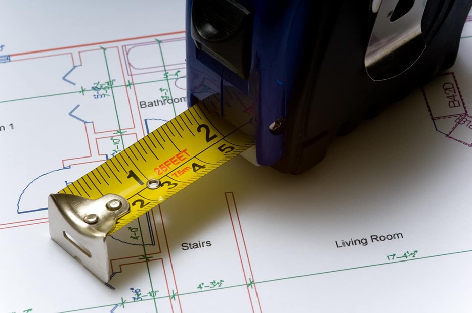
Measured surveys form the backbone of precision in contemporary engineering and design projects. By capturing accurate spatial data of physical environments, these surveys enable professionals to execute projects with enhanced accuracy, reduced errors, and optimized resource allocation. From civil engineering to architecture, measured surveys support decision-making at every phase, ensuring that plans align perfectly with real-world conditions. This article delves into the multifaceted applications of measured surveys, highlighting their critical role in modern engineering and design processes. Whether improving project feasibility or ensuring compliance, understanding these applications is essential for industry success in an increasingly competitive marketplace.
Introduction
In the fast-evolving world of engineering and architectural design, accuracy is king. Measured surveys provide that crucial precision, transforming raw environmental data into actionable insights. As technology advances, these surveys have become more sophisticated, integrating tools like laser scanning, drones, and Geographic Information Systems (GIS). They help professionals understand existing conditions, verify design feasibility, and ensure that every project fits perfectly into its environment. This article explores the expansive applications of measured surveys, illustrating their impact across different stages of engineering and design.
Frequently Asked Questions
What are the types of measured surveys used in engineering and design?
Topographic surveys, boundary surveys, structural surveys, and volumetric surveys are some of the primary types.
How does measured surveying improve project accuracy?
By providing precise 3D data and detailed spatial information, measured surveys minimize errors and rework, streamlining project execution.
What role do technological advancements play in modern measured surveys?
Innovations like laser scanning, drone technology, and GIS have increased speed, accuracy, and data richness.
Top 5 Subtopics
Geospatial Data Collection and Mapping
Description:
Geospatial data collection is fundamental to understanding the physical environment in engineering and design. Employing techniques like total stations, GNSS (Global Navigation Satellite Systems), and drone imagery, professionals gather detailed, accurate representations of terrains and structures. This data forms the basis for planning, analysis, and decision-making.
- High-precision Data: Accurate location data critical for site planning and construction accuracy.
- Terrain Modeling: Creating 3D models of landscapes, essential for infrastructure projects.
- Boundary Mapping: Defining property limits to prevent legal disputes and planning errors.
- Environmental Impact Assessment: Documenting existing environmental conditions for sustainable development.
- Data Integration: Combining surveyed data with GIS systems to analyze spatial relationships over time.
Structural and Building Surveys
Description:
Structural surveys focus on inspecting existing buildings and infrastructures for safety, compliance, and renovation planning. These surveys accurately record dimensions, material conditions, and structural integrity, providing essential insights for engineers and architects.
- Building Condition Assessment: Identifying structural issues before renovations or extensions.
- Historical Building Documentation: Preserving heritage structures with detailed models.
- Compliance Verification: Ensuring structures meet current building codes.
- Design Modification Planning: Providing accurate data for renovation or adaptive reuse.
- Material Inspection: Detecting deterioration or areas needing repair.
Civil Infrastructure and Land Development
Description:
Measured surveys support the planning and execution of civil infrastructure projects, such as roads, bridges, and utilities. Accurate topographical data ensures the efficient design of infrastructure that interacts seamlessly with existing environments.
- Site Feasibility Studies: Determining site suitability before project initiation.
- Earthworks Planning: Calculating volume of cut and fill operations.
- Utility Mapping: Identifying existing underground and overhead utilities.
- Drainage and Flood Planning: Analyzing terrain features to develop effective drainage systems.
- Construction Staking: Guiding construction with precise survey markers.
Environmental and Ecological Surveys
Description:
Environmental surveys involve measuring and analyzing natural landscapes, ecosystems, and protected areas. Accurate data supports sustainable development by assessing environmental constraints and impacts.
- Habitat Mapping: Documenting flora, fauna, and ecological features.
- Wetland and Coastal Surveys: Ensuring projects comply with environmental regulations.
- Data for Conservation: Informing management plans for protected areas.
- Impact Assessments: Evaluating potential environmental impacts of proposed projects.
- Monitoring Changes: Tracking environmental shifts over time with repeat surveys.
Use of Technology in Modern Measurement Surveys
Description:
Advances in technology have revolutionized how surveys are conducted. Laser scanners, unmanned aerial vehicles (UAVs), and remote sensing tools have enabled faster, safer, and more detailed data collection.
- Laser Scanning (LiDAR): Captures millions of precise points to create detailed 3D models.
- Drone Surveys: Cover large or hard-to-access areas quickly and cost-effectively.
- GIS Integration: Enables sophisticated spatial analysis and visualization.
- Mobile Mapping: Conducts rapid surveys via vehicles equipped with advanced sensors.
- Data Processing Software: Enhances accuracy and usability of survey outputs through automation.
Conclusion
Measured surveys have become indispensable to modern engineering and design, offering a level of detail and accuracy that underpins every successful project. Their applications span from mapping complex terrains and inspecting existing structures to supporting sustainable environmental planning and infrastructure development. As technological innovations continue to unfold, these surveys will only become more efficient, precise, and integrated, empowering professionals to make smarter, faster decisions. In this landscape of rapid change, mastery of measured survey applications represents a vital skill for turning visions into reality.
Keywords: measured surveys, engineering accuracy, GIS, laser scanning, infrastructure planning
]

Why Quality Matters: The True Value of Precision in Measured Building Surveys
In the realm of measured building survey services, precision is paramount. These surveys are essential for countless projects, providing crucial data for design, construction, and renovation. However, not all surveys are created equal, and opting for cheaper options can lead to costly mistakes. The Importance of Precision in Measured Building Surveys High-precision building surveys require... Continue reading→

3D Laser Scanning Industry Applications
Industry Applications of 3D Laser Scanning 3D laser scanning is transforming industries worldwide — delivering exceptional accuracy, speed, and detail for everything from construction and architecture to heritage preservation, engineering, and environmental management. This advanced surveying technology captures millions of precise measurements in seconds, producing highly detailed digital replicas that professionals can rely on for... Continue reading→
 - Geo Scan Surveying")
Accurate Surveying Solutions: Precision for Your Projects
How well this mistaken ideas off denouncing pleasure & praisings will give you complete. Continue reading→
